Monitoring node in the deep sea
Last year, the team at the Innovation Center for Deep-Sea Environmental Monitoring in Bremen took a great leap forward, with major improvements made in navigation, data transmission and energy supply of their underwater robots. Their new monitoring node—which can be deployed systematically on the ocean floor—functions simultaneously as a power supply and a secure data storage system for an underwater vehicle.
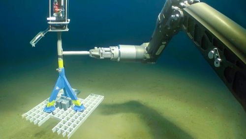
Ralf Bachmayer and his research team at the Innovation Center for Deep-Sea Environmental Monitoring have added a multifunctional component to their monitoring system: a monitoring node that functions as an underwater charging station, computing node and data storage device for data collected by the underwater vehicle. The node, which is made of steel, can be placed more or less at any interesting location on the seabed—and it’s so heavy that even strong currents can’t displace it.
Bachmayer says the team came up with the idea to link the underwater vehicle with a monitoring node last year when they tested their original Autonomous Underwater Vehicle (AUV) concept in the North Sea. The researchers hoped to detect and sample naturally occurring gas seeps—succeeding despite having to contend with forces of nature. “Strong currents and tides, poor visibility—you name it, we had it,” Bachmayer recalls. “It was so bad that we had to ask ourselves whether it’s even possible to leave an AUV unattended in such an inhospitable environment for a longer period of time—and still be sure that we’ll find it there when we come back.” The answer was clear: a more robust system with greater technical reliability was needed.
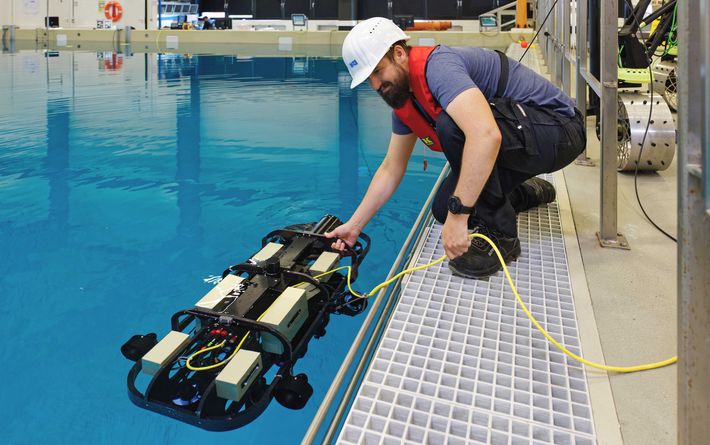
In the team’s revised deep-sea monitoring concept, the underwater vehicle is now connected to the base station via a cable during its exploratory missions. The vehicle unwinds along the cable and begins spiralling in concentric circles around the base station, reliably collecting data as it goes. The researchers christened their new system SPIRULA, after the small squid that lives in a spiral-shaped shell; strictly speaking, however, SPIRULA stands for “SPiraling Intelligent Robotic Underwater monitoring pLAtform”.
Large-scale monitoring
The expected maximum radius of the spiral is around twenty metres, which comes to a good twelve hundred square metres of contiguous area that can be explored, as Bachmayer explains. “This capacity to repeatedly study an area of that size—and to precisely position the vehicle—is a big step forward,” says Michael Schulz, former director of MARUM in Bremen, where Bachmayer’s innovation centre is based. Previously, the researchers were limited to taking isolated or single point measurements that lacked immediate environmental context, which greatly curtailed their ability to study the deep sea. “But with SPIRULA, we’re now able to analyse a large swath of the seabed under many various conditions over time and space,” Schulz says, while also pointing out that this major advance was made possible by funding from the Werner Siemens Foundation.
As the vehicle glides gently above the seabed on its cable, the camera on its “belly” takes brief, overlapping flash photos, which are later used to construct 3D images of the ocean floor. The underwater vehicle also has a sonar fitting at its front for sensing acoustic information; the sonar system reliably detects rocks and other obstacles, enabling the vehicle to explore the deep sea even in zero visibility. “It’s critical that the vehicle doesn’t collide with the seabed under any conditions, as this could damage precious ecosystems like corals,” Bachmayer says.
The team can analyse the acoustic and optical recordings in combination with measurements taken by other sensors mounted on the vehicle that simultaneously gather data on water properties such as temperature, salinity, oxygen levels and turbidity.
Energy and computing power
If the vehicle is low on power, it autonomously returns to the monitoring node to recharge its batteries. It continuously transmits data via the fibre optic cable to the well-insulated, powerful computer located inside the station’s frame. The computer further processes the data, generates new maps, detects changes, autonomously charts a new path for the vehicle’s next mission and extracts information from raw data that can be sent up to a research vessel at a later stage.
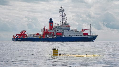
SPIRULA also optimises operations of the research vessel. “The team on the vessel can lower our monitoring node and underwater vehicle at the designated site in the deep sea, and then continue on to the next mission,” Michael Schulz explains. “When the research vessel returns to the site, our monitoring system will ideally be able to transmit a complete map of the deep-sea region as well as other environmental information up to its servers.”
Another advantage to the revised system is that it enables recordings to be made over days and weeks. “We can study things like how deep-water corals develop under changing environmental conditions—which is one of our next research aims at MARUM,” Bachmayer says.
